1940s Map of Henderson, NV
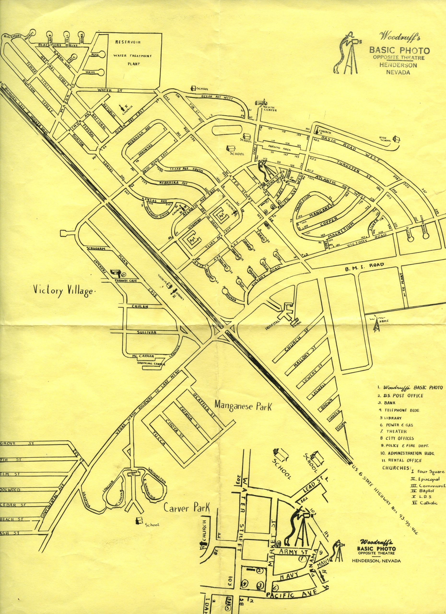
This map, from our collections was created by Woodruff’s Basic Photo of Henderson, NV, and shows the Basic townsite built to house workers of Basic Magnesium, Inc. (BMI). BMI opened in 1942 to process magnesium needed for WWII. It created a migration of out-of-town workers and their families to the area, so housing dedicated to them was needed as there was nothing available at the time. Architect Paul Revere Williams was hired to design the housing for what became known as the Basic townsite. He would go on to design the La Concha Hotel (now the reception of the Neon Museum), El Morocco Hotel and the Royal Nevada Hotel and Casino as well as the Berkley Square neighborhood in today’s Historic Westside. The Basic townsite included the 509-unit Victory Village and the racially segregated 324-unit Carver Park and featured a post office, library, theater, office buildings, and multiple schools and churches. It would eventually grow to be Henderson, NV.